
New Atlas Maps Highlighted in CityLab
Yesterday, CityLab published a story on the new mapping breakdowns added to the National Equity Atlas. The author, Laura Bliss, underscores the role spatial data has played in understanding and addressing inequity. She writes,
"Mapmakers are still figuring out the best ways to plot disparities across all sorts of measures—jobs and school quality, environmental health, and transportation access, for example—to advocate for policy change. The National Equity Atlas, developed by PolicyLink and the University of Southern California’s Program for Environmental and Regional Equity (PERE), might be the best and most comprehensive graphic call for economic equality available today.”
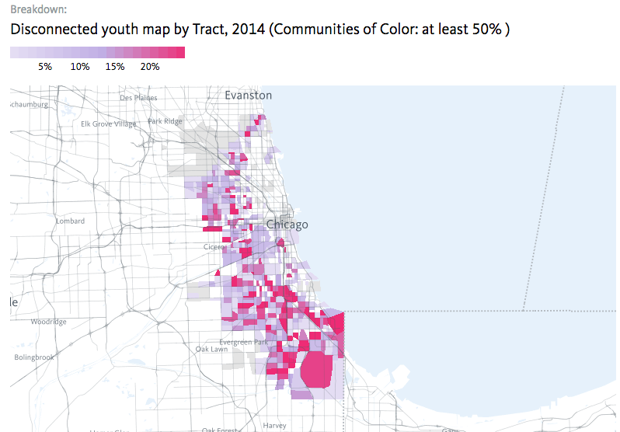
The article highlights disconnected youth and unemployment maps in communities of color for the United States overall and in the city of Chicago. Check out the new maps for yourself on the following indicators: people of color, race/ethnicity, unemployment and disconnected youth.